
Project H — Hautajärvi Uranium Project
Overview
Two targets, trenched and drilled by a former operator, then left open and never followed up — in NE Finland’s Kuusamo gold–uranium belt.
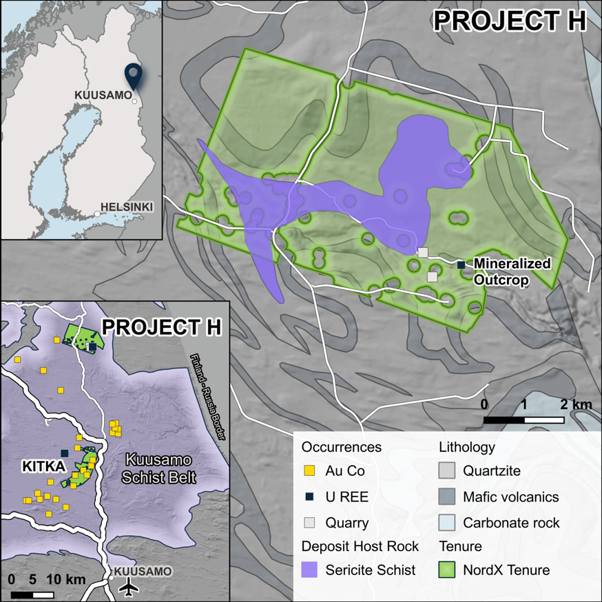
At a Glance
Location
Salla, Lapland, NE Finland — ~40 km south of Salla town, just south of the Arctic Circle; Kuusamo Schist Belt
Tenure
Exploration reservation VA2025:0049 — a priority right to apply for an exploration permit (not a permit); ~36.3 km²; registered Oct 2025, valid to September 29, 2027
Holder
Swedish Minerals AB (a NordX subsidiary)
Commodities
Uranium (± gold, cobalt, copper)
Deposit Style
Albitite / sodium-metasomatic uranium (uraninite ± davidite)
Prior Operator
Agricola Resources plc — trenched and drilled 2005–2007
Stage
Reservation; historic drilling; no modern follow-up
The Story
In 2005–2007, Agricola Resources plc trenched and drilled the “Energy Ridge” prospect — a uranium mineralised surface zone in the Kuusamo–Paanajärvi belt — intersecting uranium mineralisation in a small six-hole, 252 m program, before relinquishing the ground in 2007. It has had no modern follow-up since. NordX has reconsolidated the belt and holds a reservation — a priority right to apply for an exploration permit over the same ground.
Geology & the Target
The ground lies in the Kuusamo Schist Belt, a Palaeoproterozoic belt the Geological Survey of Finland maps as a cobalt–gold permissive tract. Energy Ridge mineralisation sits at a lithological contact in a red albitite breccia and altered albite metadiabase cut by dolomite veins — a sodium-metasomatic (albitite) setting — on a coincident airborne radiometric (uranium) and magnetic anomaly. The primary uranium mineral is reported (operator petrography) as uraninite with davidite; the secondary uranium minerals at surface are peer-reviewed (Plášil et al., 2010). The regional model for a combined system is the nearby Kouvervaara occurrence (uranium alongside a cobalt–copper–gold body).
Two historic uranium targets sit on the ground — the trenched and drilled Energy Ridge zone, and a separate high-grade uranium boulder occurrence ~3.6 km to the WNW whose bedrock source was never located — plus several further untested radiometric zones, none tested by modern geophysics or drilling. The exploration logic is direct: trace the boulder float to its bedrock source, assay the untested radiometric zones, and follow up Energy Ridge with modern geophysics and drilling — a clear set of leads for a modern program, subject to securing an exploration permit.
Beyond uranium, a GTK-recorded cobalt(–gold) occurrence (Pattasoja) also plots inside the reservation — consistent with the belt’s cobalt–gold endowment. It is a catalogued occurrence, not a defined resource, but it adds a cobalt dimension to the ground alongside the two uranium targets.
Historical Results
Historical, third-party, exploration-stage figures — non-compliant, not independently verified, and no compliant mineral resource exists. Surface figures are selective grab/channel samples; units are kept as originally reported.
- Best surface bedrock rock chip sample — up to 1.8% uranium oxide (single highest).
- Surface samples (average) — over 0.2% uranium oxide (selective samples).
- Trench A — a 10 m channel averaging 0.36% uranium oxide, with continuous high radiometric readings.
- Trench C — 5 m at 0.16% uranium oxide.
- Hole HA005 — 0.90 m at 0.33% U₃O₈, within a 7 m albite-carbonate mineralised zone.
- Hole HA006 — 1 m at 0.19% U₃O₈, within a 5.8 m zone.
Heavy core loss — the historic grades likely understate what’s there. The operator (Agricola) reported heavy core loss in and above the mineralised zones, so its reported grades and widths likely understate the true intersections — a modern, well-recovered re-drill is the obvious opportunity. The program was small (six holes for 252 m, sub-metre best intercepts) and unverified, so it confirms the presence of uranium, not a defined body.
Important Considerations
- Reservation only — a priority right to apply, not a permit, mining right or mineral resource; conversion to a permit is not assured.
- Historical, third-party figures — all grades are Agricola (2005–2007), non-compliant and not independently verified; the best drill intercepts are sub-metre with core loss, the boulder source is un-located, and the targets’ placement is interpreted from the operator’s maps.
- No gold/cobalt resource — the polymetallic angle is a concept; no gold or cobalt grade is defined on this ground.
- Early-stage — value depends on securing a permit and on modern exploration; historical results are not a guarantee of future results.